About one nautical mile south-southeast of Mamula Island, the British submarine HMS H3 rests upright on the seabed at a depth of approximately 75–79 metres. Destroyed by an Austro-Hungarian defensive mine on 15 July 1916, the wreck is the final resting place of all 22 submariners who were aboard and one of the most important First World War underwater sites in Montenegro.
Submarine / Near Mamula
HMS H3
About one nautical mile south-southeast of Mamula Island, the British submarine HMS H3 rests upright on the seabed at a depth of approximately 75–79 metres.
From the collection
Closer to the evidence.
The research narrative
A deeper reading.
British Submarine HMS H3
About one nautical mile south-southeast of Mamula Island, the British submarine HMS H3 rests upright on the seabed at a depth of approximately 75–79 metres. Destroyed by an Austro-Hungarian defensive mine on 15 July 1916, the wreck is the final resting place of all 22 submariners who were aboard and one of the most important First World War underwater sites in Montenegro.
A new naval weapon
Submarines were still a relatively new technology when the First World War began, but they quickly demonstrated their ability to threaten even the largest surface warships. Their principal advantage was stealth: a submerged vessel could approach an enemy formation or naval base before launching torpedoes at close range.
Britain entered the war with a sizeable submarine fleet, but the early successes of German U-boats revealed weaknesses in British designs and operational doctrine. The Royal Navy responded by expanding its submarine programme, including the rapid construction of vessels based on the American Holland 602 design.
The British H class
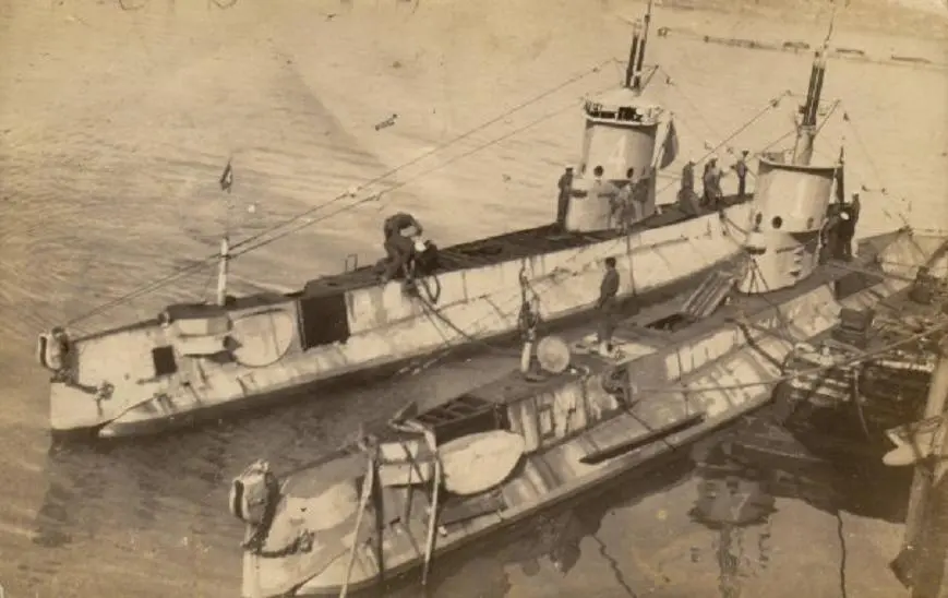
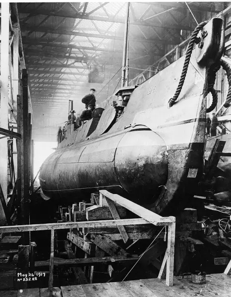
HMS H3 belonged to the first group of British H-class submarines. These boats were based on a design developed by the Electric Boat Company of Groton, Connecticut, and were built under licence by Canadian Vickers in Montreal during 1915.
The submarine was approximately 45.8 metres long and 4.8 metres across the beam, with a draught of about 3.8 metres. Published figures place its displacement at approximately 358–364 tonnes on the surface and about 434 tonnes when submerged.
Two diesel engines powered the submarine on the surface and charged its batteries. Once submerged, two electric motors drove the propeller shafts, allowing the boat to remain underwater without producing visible exhaust.
The H class could reach approximately 13–14 knots on the surface and about 10 knots submerged. Its operational diving depth was around 60 metres, although the hull may have been able to withstand somewhat greater pressure under favourable conditions.
Weapons and crew
The submarine’s principal armament consisted of four 457-millimetre, or 18-inch, torpedo tubes mounted in the bow. It carried a limited number of spare torpedoes, generally six to eight in total.
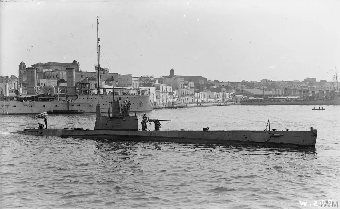
After reaching the Mediterranean, the early British H-class submarines were fitted with additional equipment, including radio apparatus, protective cables intended to help them pass through anti-submarine nets and a small deck gun—reported as a 57-millimetre or 6-pounder weapon.
Conditions inside the boat were extremely confined. Officers and ratings worked, ate and slept among batteries, machinery, torpedoes and stored provisions. Fresh water was strictly rationed, ventilation was poor, and most crew members shared bunks in shifts under the “hot-bunking” system.
Across the Atlantic
HMS H3 was one of the first British H-class submarines completed in Canada. Together with HMS H1, H2 and H4, it crossed the Atlantic in the summer of 1915 under escort by the armed merchant cruiser HMS Calgarian.
Mechanical problems affected H3 during the passage, and the submarine reportedly required towing for part of the journey. After repairs and preparations at Gibraltar and Malta, the vessel was assigned to operations in the Adriatic.
Its operational base was Brindisi in southern Italy. From there, British, French and Italian submarines patrolled the eastern Adriatic coast and watched the movements of the Austro-Hungarian Navy.
War in the Adriatic
The Bay of Kotor—then known internationally as Cattaro—was Austria-Hungary’s principal operational naval base in the southern Adriatic. Cruisers, destroyers, torpedo boats, submarines and auxiliary vessels used the sheltered bay as a base for attacks against Allied shipping, Albanian ports and the Otranto Barrage.
For Allied submarine commanders, the concentration of warships inside the bay made Kotor an attractive but extremely dangerous target. The entrance was protected by coastal artillery, patrol boats, observation stations, anti-submarine barriers and extensive defensive minefields.
French submarines had already attempted to enter the bay. Cugnot penetrated the outer approaches in November 1914 before Austro-Hungarian forces detected and drove it away, while Bernoulli entered part of the bay in April 1915 but found no suitable target.
The final patrol
At 08:30 on 14 July 1916, HMS H3 departed Brindisi under the command of Lieutenant George E. Jenkinson. Its orders concerned operations off the Austro-Hungarian coast and the approaches to the Bay of Kotor.
During the night, the submarine approached the Montenegrin coast while travelling on the surface and charging its batteries. Before daylight on 15 July, it submerged south of Mamula to reduce the risk of detection by Austro-Hungarian patrol vessels and seaplanes.
Available evidence indicates that H3 then proceeded toward the entrance to the bay. The submarine may have been attempting to penetrate the naval defences and attack shipping inside, although the exact intentions of its commander cannot be reconstructed with complete certainty from the surviving evidence.
The explosion
At approximately 13:27 on 15 July, personnel at the Austro-Hungarian signal station on Cape Oštro heard a muffled explosion from the sea south of Mamula. A patrol vessel sent to investigate found a large patch of oil, floating wreckage and reportedly part of a torpedo.
The French submarine Faraday, which was also operating in the southern Adriatic, reported hearing a powerful explosion at approximately the same time. No distress signal was received from H3, and no member of its crew reached the surface.
The most strongly supported explanation is that the submarine entered one of the Austro-Hungarian defensive minefields guarding the Bay of Kotor. The explosion destroyed the bow and sent the vessel rapidly to the seabed.
How the mine struck
The pattern of damage observed on the wreck suggests that H3 may have caught the mooring cable of a contact mine with one of its forward hydroplanes or another projecting part of the hull.
As the submarine continued moving, the cable could have pulled the mine downward until one of its contact horns struck the bow. Breaking the chemical ampoule inside the horn would have activated the detonator and exploded the main charge.
The blast may also have detonated or damaged one or more torpedo warheads carried in the bow compartment. A secondary explosion would help explain the near-total destruction of the forward section, but this possibility has not been conclusively demonstrated.
The crew
All 22 officers and ratings aboard HMS H3 died. There was no opportunity to abandon the submarine, and the scale of the bow damage indicates that survival inside the pressure hull would have been impossible.
Among those lost was the commander, Lieutenant George E. Jenkinson, and his young second-in-command, Sub-Lieutenant William English Tatham. Born in Pietermaritzburg, South Africa, in 1897, Tatham had joined the Royal Navy as a cadet and was only 19 when he died.
The names of the crew are commemorated at the Portsmouth Naval Memorial, which honours Royal Navy personnel from the two world wars who have no known grave other than the sea.
The wreck today
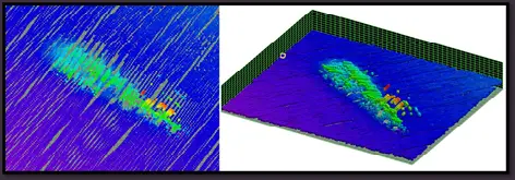
The remains lie on a sandy and muddy seabed approximately one nautical mile south-southeast of Mamula Island. Reported depths across the site range from about 73 to 75 metres.
The submarine rests upright, with its bow pointing approximately north-northwest. The stern and central hull preserve the recognizable form of an early twentieth-century submarine, but the forward section has been almost completely destroyed.
Damage extends from the bow nearly to the conning tower. Only the keel, sections of the lower structure and relatively narrow areas of hull plating continue to connect parts of the shattered bow with the remainder of the vessel.
Much of the upper deck has disappeared, while the surviving metalwork is densely covered with marine growth. The distribution of damage strongly supports the historical account that H3 was destroyed by a mine rather than lost through mechanical failure or a diving accident.
Recording HMS H3
The approximate position of the submarine appeared on nautical charts during the Yugoslav period, but the wreck was not systematically examined for many decades.
In spring 2023, the French Navy minehunter Lyre inspected and filmed the wreck with a remotely operated vehicle. The mission was connected with the continuing search for the French submarine Monge, also lost in the southern Adriatic during the First World War.
The resulting video confirmed that the wreck was consistent with a British H-class submarine and documented the extensive destruction of its bow. The survey also demonstrated the value of remotely operated systems for investigating deep and sensitive sites without placing divers at unnecessary risk.
A maritime war grave
HMS H3 is not an ordinary shipwreck or recreational attraction. It is the final resting place of 22 sailors and must be treated as a maritime war grave.
As a former British naval vessel, the submarine also retains a special sovereign and commemorative character. The precise interaction between British sovereign immunity, Montenegrin cultural-heritage legislation and any formal British statutory designation should be confirmed by the competent authorities before making detailed claims about its legal classification.
Because the submarine has remained underwater for more than 100 years, it falls within the chronological definition of underwater cultural heritage established by the 2001 UNESCO Convention. This supports its preservation in situ, non-destructive documentation and protection from unauthorized disturbance.
Diving and protection
At 75–79 metres, HMS H3 lies far beyond ordinary recreational diving limits. Reaching it requires advanced technical-diving qualifications, trimix breathing gases, redundant equipment and extensive decompression planning.
The depth is only one of the hazards. Darkness, cold water, reduced visibility, fishing gear, unstable metalwork and the possibility of unexploded ordnance make the wreck a particularly demanding and sensitive site.
Penetration should not be attempted. No object should be touched, moved or recovered, and the bow must be treated as an especially sensitive area because it may contain torpedoes, human remains and evidence of the mine explosion.
Future investigation should rely primarily on multibeam sonar, remotely operated vehicles and carefully controlled photogrammetry. A detailed 3D model would support archaeological analysis and allow the public to explore the submarine virtually without disturbing the wreck or its crew.
Remembering H3
The wreck tells several interconnected stories: the rapid development of submarine technology, the international character of the First World War and the strategic importance of the Bay of Kotor.
It also preserves the story of a small crew sent on an exceptionally dangerous mission. Their submarine crossed the Atlantic, operated from Mediterranean bases and ultimately disappeared within sight of one of Austria-Hungary’s most heavily defended naval strongholds.
HMS H3 should therefore be presented first as a memorial and only then as an archaeological site. Through respectful research, international cooperation and digital interpretation, its history can be made accessible without compromising the dignity of those whose grave remains beneath the sea.
Built: 1915
Draught: approximately 3.8 metres
Armament: Four 457-millimetre bow torpedo tubes and a small deck gun
Commander: Lieutenant George E. Jenkinson
Wreck position: Upright, bow directed approximately north-northwest
Condition: Forward section almost completely destroyed; central and after sections more recognizable
Modern survey: Discovered by RPM Nautical Foundation MBES survey, resurveyed by the French minehunter Lyre in 2023
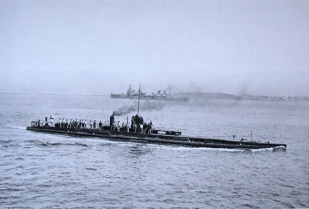 MongeSubmarine · Montenegrin coast
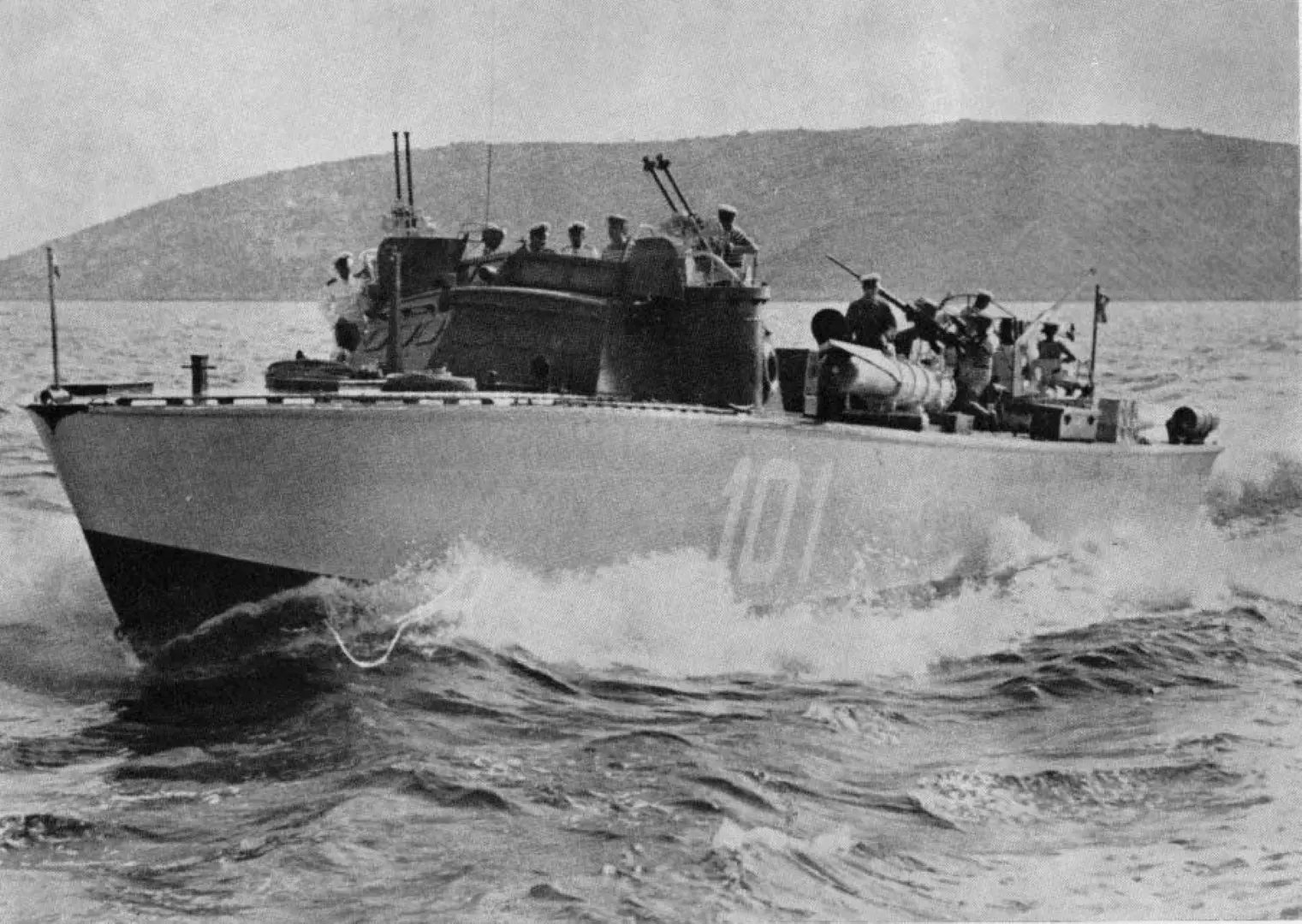 Higgins 78Torpedo boat · Bay of Kotor
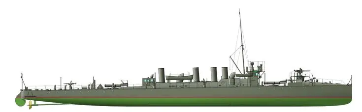 SMS HuszárDestroyer · Kalafat Reef
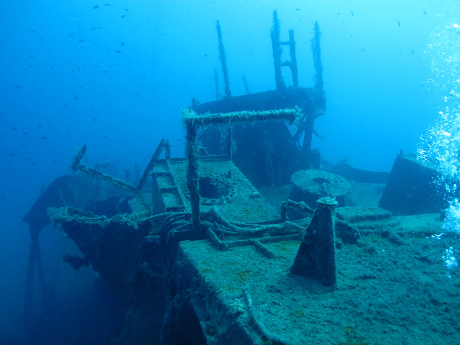 Patrol Boat PBR-512Vessel · Žanjice Bay